After determining the campaign hook in “Warlock of the Pale Moor,” we embellish the old map, original source of our inspiration.
Reading Map
Outlining a B/X D&D campaign. As sometimes happens at the outset, I thought to do this all in one article…
- Atlantis of the Clay
- Warlock of the Pale Moor
- A Forsaken Peninsula
- Thirteen Graves
- Monstrous Denizens of the Pale Moor
- Beyond the Pale
- The Hex Lands
A. DECIDE ON A SETTING.
The setting is based on a historical map, Ubbo Emmius’s Tabula Frisiae Orientalis. On the map, a broad, lowland peninsula lies between two inlets, east and west. It shares a long land border with the mainland in the south and is accompanied by a chain of islands in the north.
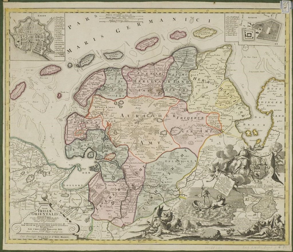
Find this map in high-resolution on the University of Groningen website at https://facsimile.ub.rug.nl/digital/collection/Kaarten/id/1410.
The map’s political boundaries (in color) define a large central region that extends to the peninsula’s west coast and is otherwise surrounded by smaller areas. To incorporate our campaign hook—opposition to the warlock and infernal hordes—I imagine that the center is a forsaken wilderness. The surrounding areas are civilized fiefs, inhabitants of which dare not enter the interior for fear of the aforementioned hordes. Each of the islands belongs to one or another of these fiefs. Beyond the colored boundaries, a few other domains, extending off the map, make land neighbors of lesser importance to the campaign. All this keeps the setting contained, focusing on the Pale Moor.
B. DRAW A MAP OF THE AREA.
We could just print Emmius’s map at a suitable scale and lay a hexagon grid over it, possibly borrowing the transparent hex sheet from the 1987 Forgotten Realms Campaign Setting box. Or we could use that as the starting point and tailor a new map to the campaign needs.
Moreover, nothing says we can’t make the peninsula larger than its real-world instance. But, as the area is part of the greater DONJON LANDS setting, I use its actual size. Another DM might do different.
Emmius’s scale (top center) is in German and Belgian miles. Forgoing the conversion, I conjure a modern satellite map. Between the points where the coast meets map’s edge, east and west, I get a distance of about 72 miles and, from north to south, around 60.
Some might balk at these dimensions. Fourty-two hundred square miles is not large for what we usually think of as a campaign area. But I am sufficiently intrigued by the map’s offerings. Plus, I’m interested to find out if we can run a campaign up to domain-level play in such a small area.
At the standard six miles to a quarter-inch hex, the map would measure a minuscule 3" × 2½", and the “postcard campaign” would become all the rage. One mile per hex would make it 18" × 15", out-sizing a US tabloid or international A3 page. Going to the extreme, if we up the one-mile hexes to a half-inch, we’d have a beautiful poster map 36" × 30" for the game room wall.
A tug on the reins and we find a happy medium at six miles per inch. The map area is 12" × 10", which fits nicely on a tabloid/A3 page with space for a legend. The larger page size allows more data. While the campaign area lacks breadth, it might compensate with detail.
One-inch hexes lack granularity. Three miles to the half-inch hex might work. Smaller one-mile hexes would be 1⁄6″. Tiny but tempting. Because, if we draw a beautiful map, we can let go the reins, print our work at 300%, and have it mounted.
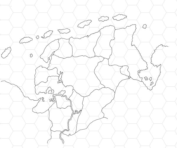
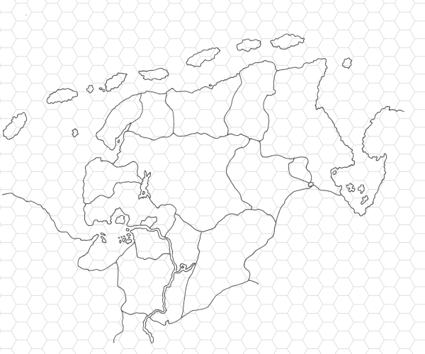
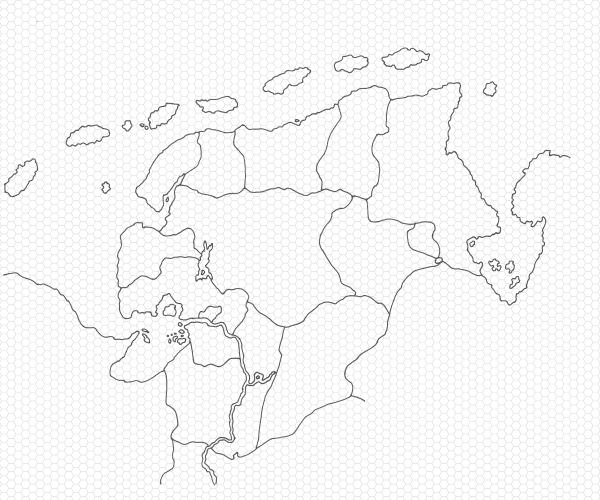
Each version employs a different hex size: one-inch, half-inch, and sixth-inch.
C. PLACE THE DUNGEON AND THE BASE TOWN.
Magic words. “Place the dungeon and the base town” hold power. Whether read silently to oneself or spoken aloud, they deliver a zap! to the mind that brings the process of wilderness design alive. This small step joins the wilderness environment and the adventure locale to create the microcosm that is to be a campaign setting.
Primary Dungeon
On Emmius’s map, the upper right inset shows the domain of Aurich, which is near the center of the interior region—ideal placement for the campaign’s principle adventure locale. We may well preserve the domain’s design: fortress with walled garden. We might embellish the garden with a necropolis, excavated by the warlock, built by the demons in ancient days or, earlier, from the time of the Greater Ones.1
Base Town
The upper left inset depicts Emden, a port city protected on its land flanks by a formidable wall. An obvious base town. I’m thinking to scale it down from city to a large town, leaving room for it to grow into a larger metropolis through the efforts of high-level PCs. We call this the “base town,” but PCs might begin their careers in smaller towns or villages, especially at campaign start.
Secondary Dungeon
Of course, we don’t forget the Pale Moor Keep itself. Laying the Valormr campaign map over the Tabula, I find the fortress in the lower east corner of the Pale Moor, in close proximity to what might be a village marked by Emmius as Straitholt. The landmark, which lies within a wooded area, serves as the location of the now ruined keep.
Secret
Secret #3: Deep below the former demon city is a gate to the Abyss. Its closing marked the downfall of the infernal metropolis. In his tower on the surface above, the warlock either works to reopen the gate or to keep it closed.
1 I should apologize for obtuse references to unexplained aspects of the DONJON LANDS setting. Instead, I promise a forthcoming article that will shed more light.
Added a secret. [07:10 9 August 2022 GMT]
Pingback: Thirteen Graves – DONJON LANDS
Pingback: Monstrous Denizens of the Pale Moor – DONJON LANDS
Pingback: Base Town Emden – DONJON LANDS
Pingback: Hekselannen – DONJON LANDS
Pingback: Encounters in the Hex Lands – DONJON LANDS
Pingback: Beyond the Pale – DONJON LANDS