Read more about the article Beyond the Pale
Troglodytes Carved Their Dwellings from Sedimentary Rock.
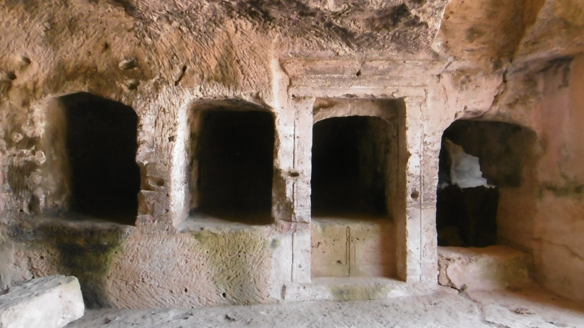
Photo: Tombs of the Kings, Cyprus.

Beyond the Pale

This is the last in a series of nine articles, which outlines a D&D campaign. This is a broad overview. Many details are left for the DM to fill in according to his or her own inspiration.

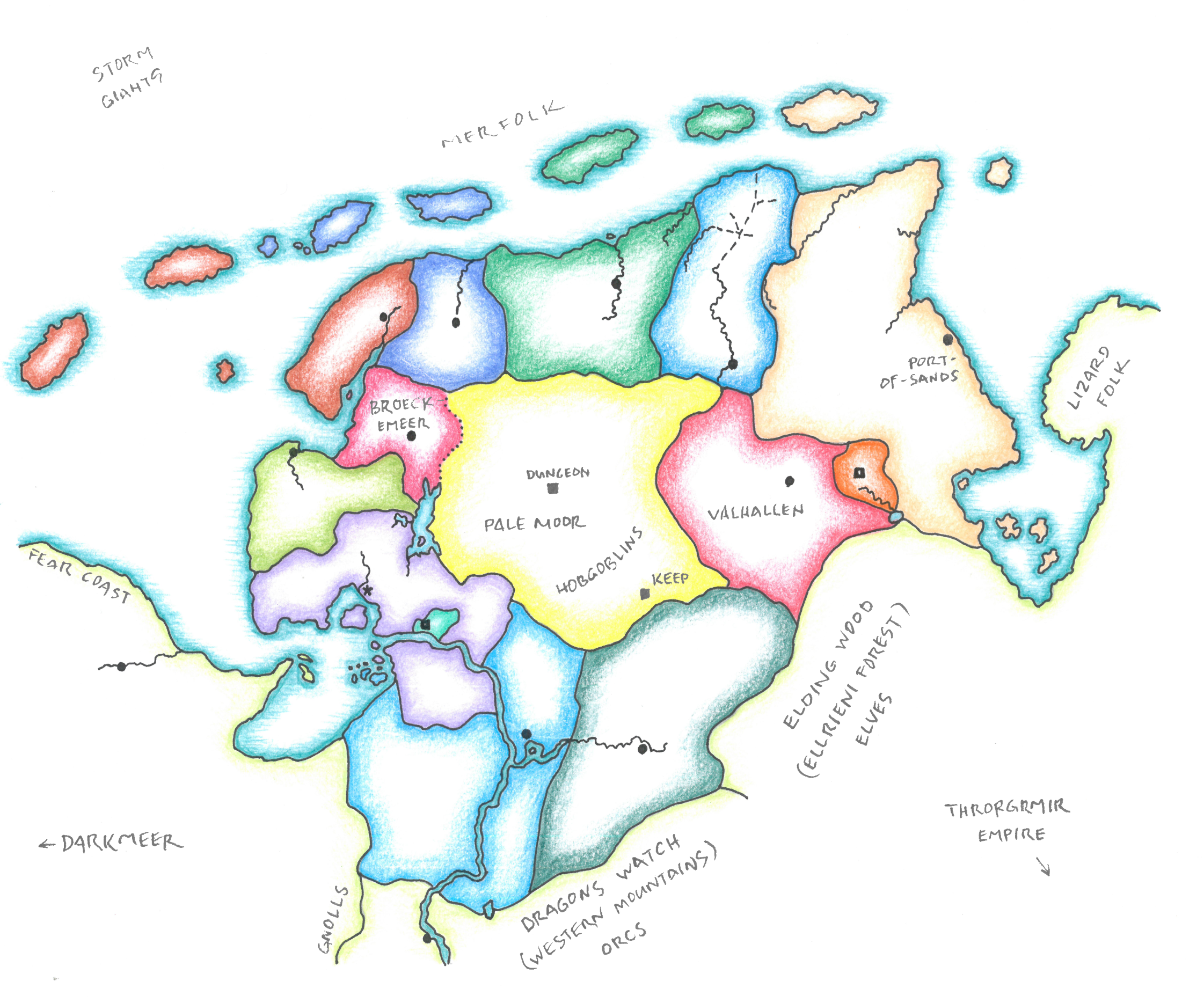
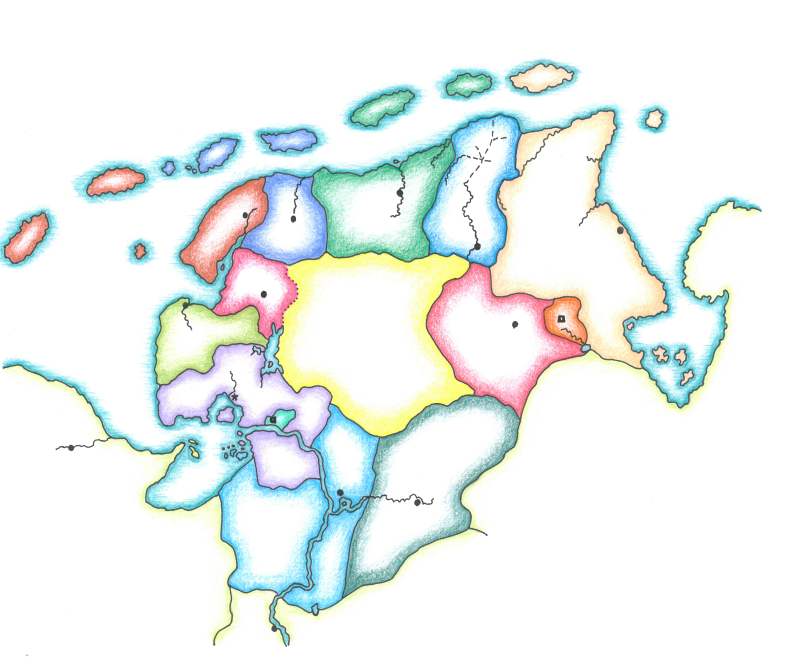
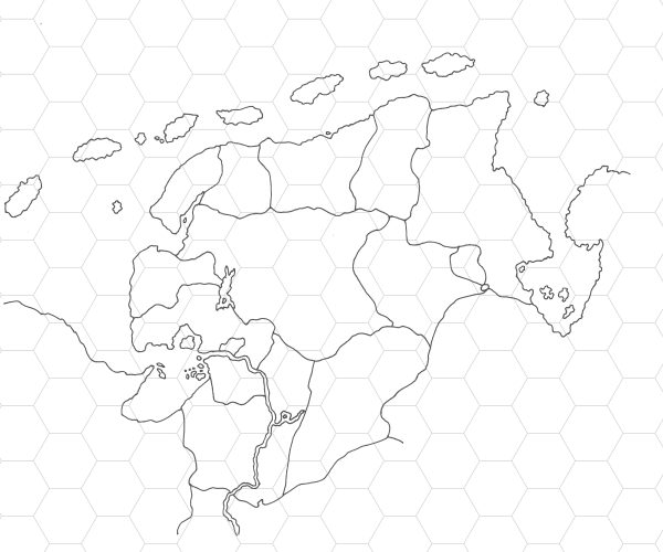
Here we cover the campaign background, generally known throughout the Hex Lands, in addition to local rumors that might be collected by adventurers. I’m working on a more elaborate campaign area map.

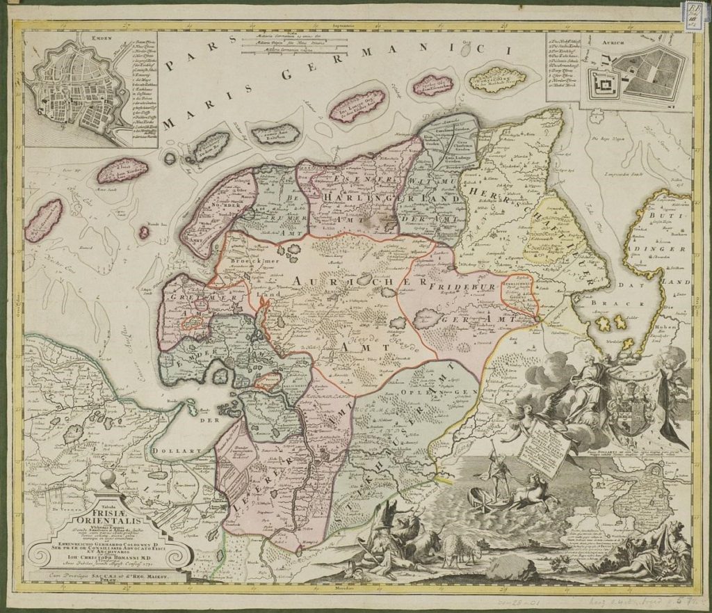
Beyond the Pale is a B/X D&D campaign inspired by an old map.

Background

Troglodytes once thrived in this lowland peninsula. Their former cave homes riddle any sedimentary rock that protrudes from the spongy bogs and shallow meres of what has been known throughout living memory as the Forsaken Peninsula.

Troglodyte legends tell of demons that sometimes ravage the land and devils that pursue devious plots. Fireside tales recount meetings with such infernal beings. These legends and rumors bring witches and warlocks to the region, seeking to practice their black arts under the tutelage of a damnable mentor.

When the Chaos Armies invaded the Throrgrmir Valley, they built a fortress on a promontory rock in the interior. The keep served as staging area and supply point for the armies that marched from Darkmeer in the west to take the dwarven citadel in the southeast. Supplies came by land from the west and from the east by sea through Port-of-Sands, which was also held by the Chaos Armies.

As the war progressed, the Forces of Law took the port and stormed the keep, cutting the enemy supply line. When Port-of-Sands was taken, a warlock who accompanied the garrison withdrew to the keep. When the keep fell, the warlock fled to the peninsula’s interior.

The Chaos Armies, denied reinforcements, were weakened but still held the citadel. Weeks of hard fighting brought the Forces of Law to the citadel’s gate and victory at the Battle of Throrgrmir.

After the war, the Throrgrmir dwarves desired to set up a buffer state between their prosperous valley and the evil denizens in Darkmeer. To draw settlers, they offered a favorable trade agreement with any who would settle the peninsula. Settlers came, and thirteen counties, called graves, were established.

In the interior, meanwhile, the warlock discovered the remains of an ancient city. Though in crumbling ruins, it contained much wealth and magic. When word spread, many adventurers came to claim the wealth, but the warlock repelled them with black magic.

The warlock enclosed the ruins inside a thick wall and built a great tower as a stronghold and base of explorations. The adventurers raised bands of mercenaries to rout out the warlock. They were defeated by an undead army. The vanquished—adventurers and mercenaries, slain and captured—all were impaled. Tall stakes bearing corpses were posted around the interior’s perimeter. Soon after, a curse was laid upon the Pale Moor: any who die within the interior rise again in undeath.

The incursions ceased. Though the curse denuded the stakes, the gruesome palisade yet remained. The perimeter came to be called the Pale, and the interior the Pale Moor.

Some four centuries have passed since the Battle of Throrgrmir. The dwarven civilization, now confronted with a primordial wyrm and its wyrmling spawn, is in decline. As their eastern ally weakens, the Thirteen Graves are threatened by the petty fiefs of Darkmeer.

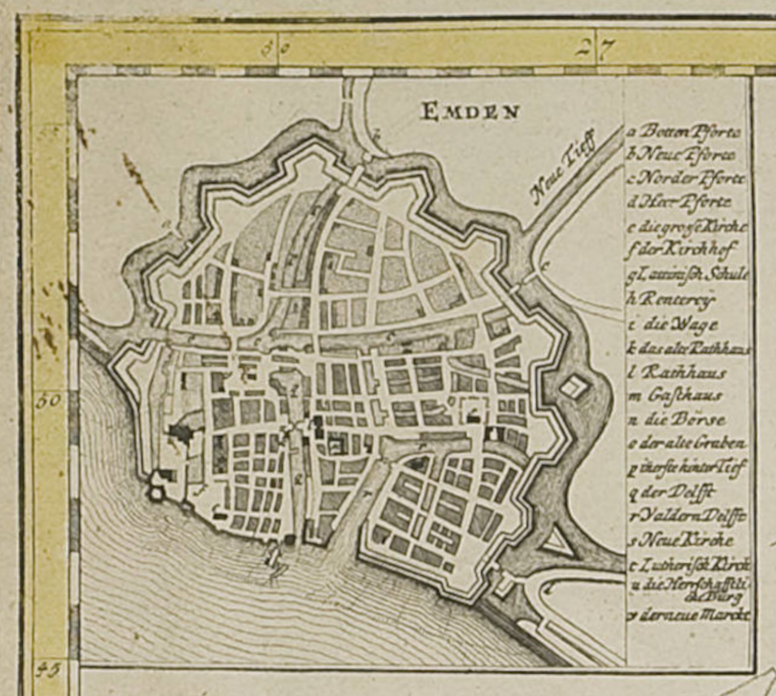
The strongest of the graves is Emder. Recently, the landgravine united eleven of the Thirteen Graves in an alliance against their common enemy to the west. The remaining two graves, Broeckemeer and Valhallan, abstained from the alliance.

The point of contention is the Pale Moor. Under the terms of the alliance, the interior and its resources are to remain unclaimed. Broeckemeer claims the Pale Moor as part of its domain. Valhallan is known to sponsor forays into the interior.

The alliance further strengthened its position by forming a duchy and promoting Emder’s landgravine to herzogin. Two of the eleven graves, though they still participate in the alliance, refused to swear fealty to the herzogin, preferring to remain independent.

On the Pale Moor, the baleful curse prevents incursion. A few dwindling troglodyte tribes, pushed out of the coastal regions, eek out an existence within the perimeter. Goblinoids sometimes cross the Pale to raid towns and villages. The disused keep long ago fell into ruin. Its location is now lost.

The Pale

pale noun
(Entry 3 of 5)

2 b : a territory or district within certain bounds or under a particular jurisdiction

3 a : one of the stakes of a palisade

Webster’s

impale verb

1 a : to pierce with or as if with something pointed
especially : to torture or kill by fixing on a sharp stake

Webster’s

Rumors

I love a rumor table. These are general entries drawn from information provided in the series. A DM should add rumors as he or she further fills out the setting. Most should apply to the opening adventure. A table of 12 is good enough to start, 20 is best. Taking a cue from Dungeon Module B2: The Keep on the Borderlands, about one-third should be false.

In addition to the background above, a player character may have heard one of the following rumors. Those marked with an f are false.

  1. The warlock retrieved a powerful artifact from the ruins of the ancient city.
  2. f The ancient city was built by demons and razed by an infernal army.
  3. Broeckemeer’s ruling family consorts with demons.
  4. The warlock’s tower is built on the foundation of a donjon of the Greater Ones.
  5. f The Keep on the Pale Moor was consumed in a great conflagration that burned for thirteen days and nights.
  6. f The Allfather released a great flood three centuries ago upon the Reidermark, whose populace worshiped devils.
  7. The herzogin sponsors worthy adventurers to make expeditions beyond the Pale.

Encounters in the Hex Lands

Reading Map

This is the eighth article of a series outlining a B/X D&D campaign inspired by an old map.

H. CREATE SPECIAL ENCOUNTER TABLES AND GENERAL LAIRS.

“There will probably be special areas of the wilderness map for which the standard encounter tables will not seem correct. The DM is encouraged to create his or her own tables for these places.”—D&D Expert Rulebook, Cook and Marsh, 1981, X54

Cook and Marsh give no guidance on how to create these tables. Should we make a simple dn table of monsters? Or should we create special tables using the Wilderness Encounters section (X57-8) as a guide—that is, an array of tables and subtables for each creature type: men, humanoid, flyer, etc., encountered in each biome: woods, river, swamp, etc.?

The latter is mighty complex, but I like the chance to encounter so many different monsters. If creating tables for large areas and the tables would get a lot of use, then I might go for that option. Before making tables from scratch, though, I would modify the existing tables, striking out undesired monsters and adding entries for those more common.

The former option is easier, although, on a simple table, each monster has an equal chance of appearing. I prefer a weighted table using two or more dice.1

We get such a weighted table in the AD&D Monster Manual II. Under the heading Creating Your Own Random Encounter Tables, we read:

“The following method of creating charts is based on the sum of 1 8-sided and 1 12-sided die, producing a range from 2-20 with a large flat spot of equal probability in the 9-13 range” (138).

Examining the odds of any given result of d12+d8, we see that the chance for each result in the “large flat spot of equal probability” is 8.33%. From there, the chance increases or decreases by 1.04% as the result goes up or down the table.

The MMII labels the flat spot as common and every two steps up and down as uncommon, rare, and very rare. Using this method, we have only to identify monsters based on the chance we’d like to encounter them.

Special Encounter Tables: Hekselannen

Roll normally on the major terrain types table (the first table of the Wilderness Encounters section, D&D Expert Rulebook, X57) to determine whether an encounter takes place. In city, inhabited, and water hexes, continue rolling on the section’s tables as normal. Re-roll any nonsensical result. (So many millennia from now, perhaps crocodiles will infest Europe’s north coast… or not.) When an encounter is indicated on the Pale Moor or its borderlands, roll on the appropriate column in the table below. See map in “Hekselannen.”

City: A hex containing a city (treat Emden as such) and within three hexes of it are considered city for purposes of determining wilderness encounters. Roll for an encounter once per week.

Inhabited: Hexes within the Thirteen Graves are patrolled, therefore, considered inhabited, except borderlands (see below). Roll for an encounter once per day.

Waterborne: Swimming or aboard a vessel on the sea or a river, roll on the ocean or river tables as normal. Roll for an encounter once per day.

Borderlands: Monsters make frequent forays into civilized lands from the Pale Moor. Borderlands are any hex within three miles of the perimeter.

Patrolled Areas and Wilderness Encounters

“The cleared area will remain free of monsters as long as it is patrolled. Patrols usually range up to 18 miles from a castle or stronghold, though jungles, swamps, and mountains will require a garrison every 6 miles to keep the area clear” (X52).

To reconcile the 1-in-6 chance for encounters in city and inhabited hexes with the above definition of a cleared area, that is, “free of monsters,” I count patrolled areas as inhabited. Much of the Thirteen Graves is swamp (fen and marsh) and clear with some woodland. Even without extra garrisons, most hexes outside the Pale Moor are within six miles of a town or stronghold. So, while “free of monsters” is optimistic, encounters are less frequent in patrolled areas.

Keep and Dungeon: In the south half of the Pale Moor, roll on the Keep table. In the north half, Dungeon.

In the table, a column for each area, before giving encounters, notes the chance for an encounter and, in parentheses, the number of times per day to roll the chance.

  1. Superscript letters E, N, S, and W designate halves of the region. For example, Borderlands entry 5, “OrcS/TrollN,” indicates an Orc encounter in the south, Troll in the north. The dividing line is left to the DM’s discretion.
  2. Where two monsters or types are given (divided by a slash “/”) without superscript designators, either choose or roll for it.
  3. Italic entries refer to subtables in the Expert Rulebook (X57-8).
  4. Bold entries refer to notes given below.
Wilderness Encounters in Hekselannen
d12+d8 Borderlands Keep Dungeon
Chance for Encounter (per day) 5-6 (1) 4-6 (2) 4-6 (2)
2 Demon Troll Demon
3 Bugbear Orc Insect
4 Standard Encounter TablesStandard Encounter TablesStandard Encounter Tables
5 OrcS/TrollN Demon Bugbear
6 Merchant Animal/Insect Flyer
7 Troglodyte Hill Giant Troll
8 Hobgoblin Bugbear Hobgoblin
9 Patrol TroglodyteTroglodyte
10 Bandit GoblinGoblin
11 Adventurers/NPC PartyKobold Unusual
12 Animal Hobgoblin Humanoid
13 Brigand Moor WraithMoor Wraith
14 Goblin/Kobold Undead Dragon
15 Flyer/Dragon AdventurersAdventurers
16 Moor Wraith Flyer Undead
17 GnollS/OgreN NPC Party Devil
18 Nomad Dragon NPC Party
19 Lizard ManE/Hill GiantW Lizard ManE/LycanthropeWLizard ManE/LycanthropeW
20 Devil DevilAnimal

Animal: Replace crocodile and elephant with wolf, tiger with dire wolf, and giant piranha with giant sturgeon.

Humanoid: Replace cyclops with kobold.

Flyer: Re-roll pegasus.

Lycanthrope: d8, 1: werebear, 2: boar, 3-5: rat, or 6-8: werewolf.

Merchant and Nomad: These are Sadhakarani, a magical race of nomad traders. See “Monstrous Denizens of the Pale Moor.”

Unusual: Replace weretiger with werewolf.

Demon and Devil: DM’s choice from lesser demons and devils. Single entities are encountered unless campaign events dictate a horde is on the march.

Moor Wraith: To determine the base creature, roll again on the same table. Ignore demon, devil, and undead. A second moor wraith result indicates a double encounter with two wraith types.

Patrol: From nearest town or stronghold. Otherwise, treat as Castle Encounter (X59). Patrols may have different characteristics. A Valhallan patrol, for example, is made up of hobgoblins. A patrol displays a banner emblazoned with the grave’s heraldic device. Each grave may be further distinguished by a distinct color (for banner, tunic, pantaloons, and other accoutrements). Patrols do not go beyond the Pale.

False Patrol: There is a small chance, say 1-in-12 or 1-in-20, that a patrol is actually a band of brigands masquerading as a local patrol, outfitted in appropriate arms and armor and accoutrements of a local patrol. The brigands are on a scouting (70%) or raiding mission (30%). If raiding, the false patrol is accompanied by an equal number of brigands, undisguised and hidden until the attack.

Embellish Patrols

I take the idea for false patrols from the World of Greyhawk Glossography, compiled by Pluffet Smedger (Relmord: Royal University, CY 998). For more ideas to add flair to your borderland patrols, see that enigmatic volume (Encounter Tables, 4-5).

General Lairs: Troglodyte Caves

Appearing wherever sedimentary rock exposes itself between the spongy bogs and shallow meres on the Forsaken Peninsula, these caves were used for centuries by the reptilian humanoids who excavated them. Where possible, the troglodytes started with natural caves or fissures, expanding tunnels and caverns according to their needs. The caves tend to be shallow, with six- to eight-feet high ceilings. Mouths of troglodyte caves often open toward the south.

The troglodyte population now much reduced, many of these caves are inhabited by goblins, some by more fearsome creatures. Few remain empty for long, if not filled with brackish water, seeping in from the rising tides that ever menace the lowland peninsula.

Cave maps
Troglodyte Caves #1 and #2.
Add scale and compass rose to suit.

Five-Room Dungeons

Five encounter areas is about right for a general sort of lair. To make these two, I referenced Mathew J. Neagley’s article on Gnome Stew, “The Nine Forms of the Five-Room Dungeon,” which I learned about recently from Dyson Logos. Lately, the map god is on a five-room dungeon binge: #5RD.

1 If you’re unfamiliar with the statistics of weighted tables, look at the odds of rolling a given number on a 2d6 table (as in Monster Reactions, B24, X23) or on a 3d6 table (as in Bonuses and Penalties Due to Abilities, B7, X2). Gygax gives a dice statistics primer in the AD&D Dungeon Masters Guide (9-10). See also Wandering DMs: Basic Dice Math | Season 1 Episode 22.

Hekselannen

Here I sketch a few details in broad strokes. I’m saving a rumor table for the final article, which pulls previous articles together into a campaign background.

Reading Map

This is the seventh article of a series outlining a B/X D&D campaign inspired by an old map.

G. FILL IN IMPORTANT DETAILS AND POINTS OF INTEREST.

Names

In the May 1999 Dungeoncraft installment (Dragon #259), Ray Winninger addresses the naming of people and places in our imagined settings. He suggests several pointers for coming up with appropriate appellations, one of which is to borrow from existing languages. “Remember this number: 400,” Winninger writes:

“That’s the Dewey Decimal Classification number for language. If you go to your local public library and browse around the 430s through about the 490s, you’ll find plenty of foreign-language dictionaries, each of which can be mined for good names.”

Being of the old school, we remember the number as well as the Dewey Decimal System and public libraries, still proud bastions of knowledge and learning. Today, though, no foray to base town is required. Online dictionaries and interactive translators put entire lexicons at our disposal.

We already covered noble titles in “Thirteen Graves.” In “Monstrous Denizens of the Pale Moor,” I made reference to a few names, which I noted on the map (reproduced above). These are examples of the system’s loose application. As source languages for this region, I lean on Frisian, Dutch, German, and Old High German, though other languages are not excluded.

Emden: Many historical names on the map are serviceable for our purpose. Seems to me that Emden (city) and Emder (county) must be related to the Ems (river). Porting all three saves us some trouble. I don’t find any etymology for the root, which leaves us carte blanche to invent a fantastic meaning for “em.”

Broeckemeer: Embellished from Emmius’s map. Suitably suspicious.

Reidermark: The name for the territory now submerged beneath the bay is also lifted from the historical map. I change it from “land” to “mark” as it was, before the flood, a boundary province. At the time of the campaign, it is most often referred to as Lost Reidermark.

Dragons Watch Mountains: Here I resort to English. We came to know them in Wyrm Dawn as the Western Mountains. Throrgrmir dwarves refer to this range as Fjallaheim (mountain home, Old Norse). Since dragons heard rumors of wyrmlings creeping in the dwarven dungeon, these low peaks make convenient roosts within easy flight of the place the Age of Dragons is prophesied to begin.

Elding Wood and Ellriendi Forest: Both names are from the Valormr Campaign. Last summer’s game flew by in a fog of war, but I believe I pulled them somehow out of Old Norse.

Valhallan (misspelled on map): Settled by a warlike clan of religious zealots, the grave takes its name from the chief god’s great hall.

Hekselannen, “The Hex Lands”: “Hekse lannen” is Frisian for “witch lands.” I concatenate to arrive at the proper appellation of the Forsaken Peninsula. From there, simple word play gets the vulgar name.

Grave Subjects

Most human PCs hail from one of the thirteen graves and, as such, are subject to the landgrave and, if the landgrave swears fealty, to the herzog. We established earlier that the graves compete with each other for the Pale Moor’s resources. Persons of the adventuring class, then, are valued subjects, provided they agree to undertake the occasional quest for the hierarchy. A subject who is known to undertake quests for other landgraves is admonished or punished according to the quest’s importance and impact. Penalties range from a small fine to public execution.

A DM might introduce the idea of adventuring licenses—something akin to letters of marque—issued by the landgraves or the herzog, which grant a limited authority to act in the name of the issuer, usually to claim land and other resources.

Total Protonic Reversal

This might qualify as crossing the streams, but there’s definitely a very slim chance we’ll survive.

I think it fairly obvious that, when naming the Keep on the Pale Moor in the Valormr Campaign last year, I had in mind the most famous keep in D&D. Then, in “About the Reedition of Phenster’s,” I mentioned the resemblance of the fictional society’s “Great Halls of Pandemonium” to the Caves of Chaos.

I want to put the two ideas together. I don’t mean that we drop in the Keep and the Caves and be done with it. I mean that we reuse parts of Dungeon Module B2 that fit the scenario. I’m thinking specifically of the Keep map and the concept of the Caves.

The Keep on the Pale Moor

We reuse the map of the borderlands Keep (B2, 16), but the once great fortress, constructed as a staging area and supply point for the Chaos Armies, is now in ruins. Recently, its walls and gates have been crudely reconstructed by its current hobgoblin inhabitants.

Maybe the hobgoblins are aware of the “secret entrance to a long forgotten dungeon” from the cellar beneath area #16 (B2, 25). Or maybe they have reason to believe it exists but haven’t found it yet.

Either way, the key to lifting the Pale Moor curse lies at the bottom of the dungeon. Therefore, the Keep on the Pale Moor becomes the campaign’s initial focal point. The PCs must, first, defeat the hobgoblins and reclaim the keep before the Wraithwright can raise an undead army. Then, using the surface ruins as a base, they must defend the keep, while they descend into the dungeon to lift the curse before the Wraithwright, with his now-raised army, destroys the keep.

The Dungeon: The Great Halls of Pandemonium

After events play out at the keep, the campaign’s focal point shifts to a ruined city of the Greater Ones, taken over by demons, rebuilt in their chaotic fashion, and named by them Pandemonium, after the capital city on their home plane. The cyclopean ruins are now sunk beneath the mires of the Pale Moor.

Because events at the keep will have an impact, it’s too early to tell what the scenario might be when PCs arrive at the Great Halls. The vision, in general terms, is to apply some of the concepts of the Caves of Chaos:

  • Each “hall” is a small dungeon, most of them connected to adjacent halls.
  • A temple is dedicated to the demons who once lived there. Within the temple complex, evil priests work to call the demons back to the Great Halls.
  • The halls are densely populated with creatures of chaos, as the evil priests gather the chaotic horde to fill the ranks of the demonic legion.

To complicate matters, the Warlock abides in a nearby tower. To further his goals, the Warlock uses devils—or devils use the Warlock to further their own.

Evil Factions

There are two major villains in the campaign. Each leads a faction. The Wraithwright, aligned with demons and chaotic evil creatures, may sometimes work with—and sometimes work against—the Warlock, aligned with devils and lawful evil creatures. Departing from B/X rules as written, the remainder of this series assumes a five-point alignment system as in Holmes Basic. (See Demons and Devils and Alignments in “Monstrous Denizens of the Pale Moor.”)

Secret #10: It was not long after the Rending and events of Song of the World Dragon that demons came to the ruined city of the Greater Ones. They sought a powerful object constructed by the now extinct beings. They found it. I don’t know yet exactly what this object is, but its misuse provoked the destruction of the rebuilt demon city of Pandemonium and sent the demons back to their home plane. It’s possible that devils, jealous of the prize, were involved. It’s probable that recovering this artifact is a primary objective of either or both of our villains. There is no doubt, though, that it may eventually be found deep in the sediment beneath the shallow bay where lies Lost Reidermark.

Base Town Emden

I thought to cover the last three steps of the D&D Expert Rulebook’s Designing a Wilderness (X54) in a single article. I try to keep the word count between 400 and 1,000. This one, covering the next step, approaches the limit. So, I cut the remainder again into parts, one article per step, and the “short” series becomes less so.

Reading Map

This is the sixth article of a short-ish series outlining a B/X D&D campaign.

F. OUTLINE THE BASE TOWN.

Description and Population

Emden is a fortified town. A river borders the south side, and defensive walls enclose the remaining perimeter. Four gatehouses at drawbridges allow entry. Canals divide the town into large quarters and give access to one small port, maybe two. The population is 10,000.

A large town gives PCs access to all the usual resources, while allowing room for growth through their actions. As the campaign progresses, PCs might reduce the monstrous threat from Darkmeer, remove the Pale Moor curse, and extract great wealth from the interior. Population increase follows.

Emden.
Inset from Tabula Frisiae Orientalis, Ubbo Emmius, 1730.

Government and Defense

The herzog maintains the seat of government in Emden. He resides in a palace (which may well be under construction or recently constructed at campaign start) and keeps a palace guard. In addition, the sovereign may raise an army. While the herzog manages affairs of the duchy,1 an appointed burgrave is charged with the administration of the grave itself, including the town. A town guard maintains order within its precincts. In case of outside threat, the burgrave may call upon the local militia.

Supporting Services

Church

The church holds great sway in the Thirteen Graves. The landgraves need the church’s support to combat the undead and the infernal menace from the Pale Moor. The church takes advantage of the situation to gain secular support to give its edicts the weight of law. A bishop (7th-level cleric) runs the church in Emden and leverages the herzog’s power to establish the church hierarchy throughout the duchy.

Secret #8: The bishop believes the church is much more capable of defending the realm and defeating the infernal hordes. He schemes to take over the duchy and make it a theocracy.

Religious Factions

Here we have an opportunity to come up with some factions within the church that promote a particular doctrine. Here follow three examples:

Crusaders: A knightly order of warriors who battle demons and devils wherever they encroach upon civilized lands. When an infernal horde gathers, the knights petition the bishop to proclaim a crusade, and they lead expeditions into the Pale Moor. Members are clerics, paladins, and fighters, knighted by the herzog.

Inquisitors: A sect that believes witchery is the root of all evil. Their inquisitors search out any practitioners of the black art. Witchery is the practice of witchcraft. In the context of our setting, witchcraft, strictly defined, is any dealing with a devil or demon. Therefore, warlocks and witches are the primary target. But sometimes the sect’s definition of witchcraft may become overly broad.2

Undead Slayers: A band of clerics that recruits warriors to destroy the abomination that is the walking dead. The band is known to make daring raids into the Pale Moor.

The Ghouling Gauntlet

Given the opportunity to reuse—or in this case pre-use—an already created element, we take it. The Ghouling Gauntlet is an ancient order of undead slayers that appears at the end of Wyrm Dawn and the beginning of Wyrmwyrd, thousands of years in our current setting’s future. Perhaps the order is recently formed in response to the moor wraiths. (See the heading The Ghoul of Tower Mill in Wyrm Dawn’s “Empire of the Undersun.”)

Guilds

Magic-Users: While it accepts members regardless of alignment, the Magic-Users Guild is dominated by lawful members, many with ties to the noble family. It maintains strong relationships with the magic-users guilds of the other lawful graves, often working together to further the herzog’s goals, which its lawful members believe coincide with their own. Chaotic members may join together temporarily to foil the efforts of the lawful group when they interfere with their own objectives.

Thieves: The Guild Master of Emden’s Thieves Guild is a member of Broeckemeer’s ruling clan. Her major ongoing operations include spying on the ducal hierarchy, harassing trade routes in and out of the capital, and political assassinations.

Lodging

Travelers and locals may find accommodation, restoration, and entertainment in a few inns, several boardinghouses, and numerous taverns. Following are examples, lightly sketched.

Gasthaus Herzogs: Situated just outside the palace gates, the herzog’s inn provides luxury quarters and gourmet meals to its wealthy clientele. It is patronized by diplomats, aristocracy, the richest merchants, and the spies who note their comings and goings and pretend not to be listening to their conversations.

Gasthof der Langenruhe or Inn of Long Repose: All sorts of travelers, including merchants, adventurers, and the occasional aristocrat, stay at this inn on the main square. Locals sometimes dine in its private dining hall. Mercenaries and men-at-arms frequent the inn’s public taproom.

Geitenhoef Taverne or the Goat’s Hoof Tavern: The southeast quarter has declined in recent years. Geitenhoef Taverne once catered to more affluent patrons. Now, its regulars are laborers, low-ranking soldiers, and adventurers down on their luck. The Geitenhoef is reputedly a hangout of members of the local Thieves Guild.

Widow Walpurga’s Pension: After her husband died 30 years ago, childless Frau Walpurga—known to everyone as Widow Walpurga or “the Widow”—began renting rooms of her large house. Her reputation is that of a kindly old woman, hard of hearing. One or two lodgers may be permanent residents. The Widow keeps one small room for herself at the top of a spiral staircase in the widow’s watch.

Witch Hunting

The landlady is named after Walpurga Hausmannin of German legend. The historic Frau Hausmannin was a tragic victim of a witch hunt. Our Walpurga may be more malefic.

Secret #9: I leave this candy to the DM. For inspiration, I refer you to the transcript of Hausmannin’s trial: “Judgement on the Witch Walpurga Hausmannin.”

To give context to the trial as well as to the general setting, I recommend Chapter 7 of Carl Sagan’s Demon-Haunted World.3 The chapter gives its title to the book.


1 I find it awkward in speech, but a DM might replace duchy with the German herzogtum.

2 An inquisition scenario might be fun. I’d be careful about letting it dominate the campaign.

3 I recommend Sagan’s book, as a whole, for it gives context to the present real-world situation. Carl Sagan, The Demon-Haunted World: Science as a Candle in the Dark, New York: Ballantine, 1996.

Monstrous Denizens of the Pale Moor

Reading Map

This is the fifth article of a short series outlining a B/X D&D campaign.

After determining human-controlled areas, it may seem little space remains for monsters. But the interior is wild and infested with ferocious beasts, walking dead, and tribes of chaotic humanoids. Surrounding the Thirteen Graves are the sea and three territories. Being borderlands, these last are wilderness areas, whose inhabitants may encroach upon civilized lands.

Secrets and Names

I debate with myself about disclosing the secrets I come up with or letting the DM make his own secrets. On the one hand, publishing them here gives them away should players become overly curious. On the other, I’m likely to build on some of the secrets in later articles. The reader must be in the know. Of course, the DM may change the secrets or devise others. I have added one secret each to “A Forsaken Peninsula” and “Thirteen Graves.” The debate continues.

I have also resisted putting names on the map, thinking to leave that to the DM as well. But place names are useful in writing as references. “The county that claims the Pale Moor” is wordy as well as awkward. I’ve written on the map a few names used in the text.

E. PLACE AREAS UNDER NON-HUMAN CONTROL.

I mention PC races at the end. Otherwise, monsters are divided by geography:

Not all monsters described are shown on the map.

Monstrous Denizens of the Pale Moor

Pale Moor

Troglodytes (not shown on map): Native inhabitants of the peninsula, the troglodytes were pushed out by human settlers. Remnants of their caves, found throughout the region, testify to their former territory. Restricted now to the interior, they often raid human settlements out of necessity if not revenge.

Kobolds (not shown): The dog-men infest the Pale Moor. They shelter in any dense thicket or tangled copse of trees.

Goblins (not shown): Goblins seek uninhabited troglodyte caves in which to make their lairs. They may be encountered most anywhere on the Pale Moor.

Hobgoblins: Inhabiting the Pale Moor’s southeast, hobgoblins frequently raid the southern graves all the way to the Gruttemar, the lake shown on the moor’s western border. To augment its army, Valhallan enlists hobgoblins, goblins, and bugbears. Parties crossing the grave’s perimeter are likely to encounter these goblinoids in border patrols.

Moor Wraiths: The result of the Pale Moor curse, these undead creatures plague the interior. Their appearance is much like a zombie: bloodless corpse, pallid complexion. Despite a vacant stare, they seem to act in concert and with a will.

Pale Moor Curse

Any creature that dies within the confines of the Pale Moor becomes a moor wraith within one day. Denizens adapt to this situation by burning their dead in impromptu ceremonies.

Secret #5: When the Battle of Throrgrmir was lost, remnants of the Chaos Armies disbanded. The Wraithwright, having arrived at the head of his undead legion near the battle’s end, still commanded the entire force. He withdrew into the Pale Moor. It is the Wraithwright who laid the curse upon the land. And it is the Wraithwright to whom the animated dead are enthralled.

New Monster: Moor Wraith

The Pale Moor curse acts as an animate dead spell, except a moor wraith has two more hit dice than the original creature. Rumors imply a moor wraith may gain additional hit dice.

Skeletal moor wraiths also exist, though they are less common. A so called “bone wraith” is created when a skeleton is brought into the moor or when the flesh of the recent dead is boiled. Bone wraiths have one more hit dice than the original creature.

Whether skeletal or fleshed, both are wraith-like in that they can only be hit with silvered or magical weapons. Moor wraiths do not drain energy levels.

Clerics turn a moor wraith as a wight or the undead creature with equivalent hit dice. A moor wraith may be dispelled. For purposes of spell failure, treat the curse as a 12th-level magic-user.

All moor wraiths act according to the desires of the Wraithwright.

Infernal Hordes: Though infrequent, demons and devils may be encountered on the Pale Moor. Hordes of these infernal creatures sometimes ravage the land, crossing into the graves to wreak havoc among the mortals.

Demons and Devils and Alignments

By adding demons and devils to a B/X game, we’re creating work for the DM. We can rob from AD&D, which is what I did in the ’80s. The biggest question lies in alignments. For me, demons and devils are distinguished by their cultures, which are tied to their alignments: havoc-wreaking demons versus Machiavellian devils. The one chaotic, the other lawful, both evil.

In a three-point, single-axis system, demons are aligned with chaos, clearly. But devils with law? Do we call them chaotic with their organized society? Or should we introduce a dual-axis alignment system?

Holmes’s five alignments are enough. DMs may decide for themselves. If incorporating more alignments, we might throw out alignment languages or restrict them to the three original alignments of the first axis. I’m thinking to experiment with only two languages: Law and Chaos.

Surrounding Lands

Lizard Men: Prowling the swamps east of the Jade Bight, the lizard men cross the bay on dark nights to raid coastal villages. They also harass shipping in and out of Port-of-Sands.

Orcs: Broeckemeer incites the orcs of the Dragons Watch Mountains to raid the southern graves. Because the orcs are unruly, the raids are infrequent, untimely, and therefore ineffective.

Gnolls: Several bands of gnolls range south along the west flank of the Dragons Watch. Broeckemeer is in contact with the gnolls, hoping to recruit them into an army when diplomatic contention comes to military conflict with the duchy. For the time being, though, the gnolls want nothing to do with the Pale Moor and its curse.

Secret #6: Broeckemeer, whose ruling family is made up of witches and warlocks (secret #4), endeavors to call upon the demon lord of gnolls to bring the rapacious bands under their dominion.

Nomads (not shown): While avoiding the Pale Moor, the Sadhakarani [introduced in Wyrm Dawn] wander throughout the peninsula and beyond, trading goods from remote lands. Also called Runefolk, they have an innate ability for magic-use.

Dragons

The Wyrm Prophecy yet unfulfilled, any number of dragons might lair on the peninsula, keeping watch over events in Throrgrmir. The most powerful among them are a black and a green (not shown). The black dragon lairs on the Moor. The green, at the edge of the Elding.

Northern Sea

Mermen: This submarine folk inhabits the deeper waters off the north coasts of the island chain. They keep to themselves and are rarely seen by fishermen and sailors.

Storm Giants: A clan of storm giants resides in a submarine castle, built from coral and giant mollusk shells. They are potential allies of law.

Secret #7: The cause of the Atlantean flood was not divine but giant. The storm giants and the knightly order were working together against chaos. I don’t know yet what was the transgression, but the order’s hierarchy crossed the storm giants in some manner. The giants’ retribution was swift, and the knightly order all but washed away.

Buccaneers and Pirates (not shown): There is a long tradition of piracy in the Northern Sea. From bases along the Fear Coast, pirates ply the channels that give access to ports in the bays either side of the peninsula. Though it is no longer a pirate holding, when referring to Thror’s Gate (off map, east, see Valormr: Pre-War Disposition of Forces), the pirates still call it Skullhaven. Broeckemeer is a reputed sponsor of pirate activity.

PC Races

Halflings: The Forsaken Peninsula is no place for such gentle people. The few haffolk who dwell here migrated with the humans from the Shire Hollows in the Throrgrmir Valley. They settle in small shires near human settlements in the lawful lands.

Elves: Any elves are from the Ellriendi Forest (Elding, Grunnthraesir, or Groennendr) also in the Throrgrmir Valley.

Dwarves: Dwarves come from either of two clans of Forn Fjallaheim in the Dragons Watch Mountains a few days march south. One clan is the Galti-Gler, the other not yet named.

Thirteen Graves

Continuing from “A Forsaken Peninsula,” we take the next step through Designing a Wilderness (Cook and Marsh, X54).

Reading Map

This is the fourth article of a short series outlining a B/X D&D campaign.

D. LOCATE AREAS UNDER HUMAN CONTROL.

Oft repeated on Emmius’s Tabula is “Amt” in conjunction with names of marked political regions. An amt is an administrative area akin to a province or county. Such small regions ruled by counts or nobles of similar rank seem appropriate.

Emmius shows ten provinces bordering the central region. Including the two small, more remote provinces—one on the river east of the Dollart, another on the opposite side of the map (left of the eastern inlet)—brings the count to 12. Twelve is a good number. Too good for a campaign with warlocks and witches, when we’re so close to 13. I’m going to carve one more county off the central region’s west end. It’s a “soft” border: the county claims, though does not control, the central region, which is the Pale Moor.

Competition

Going further with that notion, we already know that the warlock discovered much wealth and magic in the Pale Moor. So, the counties compete in some way for the forsaken interior’s resources, but they are confounded by the moor’s denizens. To increase the tension, we’ll add a curse: any who die within the confines of the Pale Moor return as undead, which also hinders incursion into the interior.

Opposition

Now, we have counties that desire something. Let’s also give them something to fear: an outside force. From the Valormr Campaign, we know that the dwarven empire of Throrgrmir lies to the east, and to the west, Darkmeer, a collection of belligerent fiefs. While Throrgrmir is a potential ally, Darkmeer is a certain enemy to civilized realms. Some time—decades or centuries—has passed since the Throrgrmir war. Darkmeer has recovered its losses and now threatens the counties with invasion, subjugation, and enslavement.

Character

Our thirteen counties should each have its own character to differentiate one from another. Space prohibits going into great detail, but we can sketch an overview of the political landscape and let the DM fill in the blanks. A handy way to divide the counties is by alignment.

Law: The counties united in an alliance against Darkmeer, a common threat. The alliance formed a duchy and elevated the ruler of the strongest county, whose seat is our base town (Emden on the Tabula), to the office of duke. The duke’s domain is shown in purple on the map, the other lawful counties in blues.

Thirteen Graves
Map of the Forsaken Peninsula Showing Political Boundaries.

Chaos: Among the counties were some abstentions from the alliance. Notably, the county that claims the Pale Moor did not join and considers itself an independent state, as does the large county on the moor’s eastern border. These counties, and others shown in reds, are chaotic.

Neutrality: A few counties that joined the alliance are less keen on subjugation to a higher ruler. Some may pay homage to the duke, but when it comes to either defending the larger realm against chaos or making fruitful gains in the Pale Moor, their fealty is uncertain. Neutral counties are shown in greens and oranges.

Atlantis of the Clay

We don’t ignore the mythical source of our inspiration (see “Atlantis of the Clay”). An order of knights once held land on the west bank of the western inlet, where now is a bay. The order charged itself with the protection of the counties against the threat of chaos. Some decades ago, the land was submerged by a sudden deluge, possibly an act of divine retribution for some transgression. Villages were covered in mud. Castles were flooded, their lower floors inundated with silt. Many knights were lost. Survivors reaffirmed the order and its mission, and the strongest county gave to the order a tract of land on the river, where the knights established a palatinate.

Titles

Taking title names from English’s Germanic roots, I exchange duke for herzog, or feminine herzogin, and count for landgrave or landgravine. A vassal to a landgrave is a graf or grafin. A more martial province is ruled by a margrave. The head of the knightly order and ruler of the palatinate is a pfalzgraf. Then, for the ambiance in it, I want to play with words a little and, instead of counties, the political districts are graves.

Secret

Secret #4: Members of the ruling family of the chaotic grave that claims the Pale Moor are witches and warlocks, who consort with demons. Maybe they are possessed, maybe willing. Their goal is not to annex the Pale Moor but to reopen the gate beneath the ancient demon city.

Added a secret. [07:16 9 August 2022 GMT]

A Forsaken Peninsula

How many times I’ve stepped through the process I cannot count. Maybe there are other ways. Maybe those ways are better. But the D&D Expert Rulebook’s Designing a Wilderness (X54) has the advantage of brevity and, after long use, familiarity. Furthermore, even after all these years, the lettered steps never fail to spark the imagination.

After determining the campaign hook in “Warlock of the Pale Moor,” we embellish the old map, original source of our inspiration.

Reading Map

Outlining a B/X D&D campaign. As sometimes happens at the outset, I thought to do this all in one article…

A. DECIDE ON A SETTING.

The setting is based on a historical map, Ubbo Emmius’s Tabula Frisiae Orientalis. On the map, a broad, lowland peninsula lies between two inlets, east and west. It shares a long land border with the mainland in the south and is accompanied by a chain of islands in the north.

Tabula Frisiæ Orientalis - Ubbo Emmius 1730
Tabula Frisiae Orientalis, Ubbo Emmius, 1730.
Find this map in high-resolution on the University of Groningen website at https://facsimile.ub.rug.nl/digital/collection/Kaarten/id/1410.

The map’s political boundaries (in color) define a large central region that extends to the peninsula’s west coast and is otherwise surrounded by smaller areas. To incorporate our campaign hook—opposition to the warlock and infernal hordes—I imagine that the center is a forsaken wilderness. The surrounding areas are civilized fiefs, inhabitants of which dare not enter the interior for fear of the aforementioned hordes. Each of the islands belongs to one or another of these fiefs. Beyond the colored boundaries, a few other domains, extending off the map, make land neighbors of lesser importance to the campaign. All this keeps the setting contained, focusing on the Pale Moor.

B. DRAW A MAP OF THE AREA.

We could just print Emmius’s map at a suitable scale and lay a hexagon grid over it, possibly borrowing the transparent hex sheet from the 1987 Forgotten Realms Campaign Setting box. Or we could use that as the starting point and tailor a new map to the campaign needs.

Moreover, nothing says we can’t make the peninsula larger than its real-world instance. But, as the area is part of the greater DONJON LANDS setting, I use its actual size. Another DM might do different.

Emmius’s scale (top center) is in German and Belgian miles. Forgoing the conversion, I conjure a modern satellite map. Between the points where the coast meets map’s edge, east and west, I get a distance of about 72 miles and, from north to south, around 60.

Some might balk at these dimensions. Fourty-two hundred square miles is not large for what we usually think of as a campaign area. But I am sufficiently intrigued by the map’s offerings. Plus, I’m interested to find out if we can run a campaign up to domain-level play in such a small area.

At the standard six miles to a quarter-inch hex, the map would measure a minuscule 3" × 2½", and the “postcard campaign” would become all the rage. One mile per hex would make it 18" × 15", out-sizing a US tabloid or international A3 page. Going to the extreme, if we up the one-mile hexes to a half-inch, we’d have a beautiful poster map 36" × 30" for the game room wall.

A tug on the reins and we find a happy medium at six miles per inch. The map area is 12" × 10", which fits nicely on a tabloid/A3 page with space for a legend. The larger page size allows more data. While the campaign area lacks breadth, it might compensate with detail.

One-inch hexes lack granularity. Three miles to the half-inch hex might work. Smaller one-mile hexes would be 16″. Tiny but tempting. Because, if we draw a beautiful map, we can let go the reins, print our work at 300%, and have it mounted.

Forsaken Peninsula - one-inch hexes
Forsaken Peninsula - half-inch hexes
Forsaken Peninsula - sixth-inch hexes
A Preliminary Map, Showing Coastlines and Counties.
Each version employs a different hex size: one-inch, half-inch, and sixth-inch.

C. PLACE THE DUNGEON AND THE BASE TOWN.

Magic words. “Place the dungeon and the base town” hold power. Whether read silently to oneself or spoken aloud, they deliver a zap! to the mind that brings the process of wilderness design alive. This small step joins the wilderness environment and the adventure locale to create the microcosm that is to be a campaign setting.

Primary Dungeon

On Emmius’s map, the upper right inset shows the domain of Aurich, which is near the center of the interior region—ideal placement for the campaign’s principle adventure locale. We may well preserve the domain’s design: fortress with walled garden. We might embellish the garden with a necropolis, excavated by the warlock, built by the demons in ancient days or, earlier, from the time of the Greater Ones.1

Base Town

The upper left inset depicts Emden, a port city protected on its land flanks by a formidable wall. An obvious base town. I’m thinking to scale it down from city to a large town, leaving room for it to grow into a larger metropolis through the efforts of high-level PCs. We call this the “base town,” but PCs might begin their careers in smaller towns or villages, especially at campaign start.

Secondary Dungeon

Of course, we don’t forget the Pale Moor Keep itself. Laying the Valormr campaign map over the Tabula, I find the fortress in the lower east corner of the Pale Moor, in close proximity to what might be a village marked by Emmius as Straitholt. The landmark, which lies within a wooded area, serves as the location of the now ruined keep.

Secret

Secret #3: Deep below the former demon city is a gate to the Abyss. Its closing marked the downfall of the infernal metropolis. In his tower on the surface above, the warlock either works to reopen the gate or to keep it closed.


1 I should apologize for obtuse references to unexplained aspects of the DONJON LANDS setting. Instead, I promise a forthcoming article that will shed more light.

Added a secret. [07:10 9 August 2022 GMT]

Warlock of the Pale Moor

Inspired by the map and the myth from last week’s “Atlantis of the Clay,” let’s make a campaign. To keep the task manageable, we’ll do only a broad overview. A DM can fill in details to suit.

I intend to follow the steps for Designing a Wilderness provided in the D&D Expert Rulebook. To begin campaign design, though, I refer to an early article from Ray Winninger’s Dungeoncraft column. Again for brevity’s sake, I won’t go through Winninger’s entire process, but the second installment of Dungeoncraft (Dragon #256) is a great way to get started. (See below Old-School D&D Campaign Building and Mapmaking Resources.)

Campaign Hook

After laying down the First Rule of Dungeoncraft, which is worth repeating to oneself every morning and every evening: “Never force yourself to create more than you must” (20), Winninger tutors the campaign builder to begin with a compelling hook. This is the “concept that captures your players’ imaginations and draws them into the game” (21). Winninger divides campaign hooks into five categories:

  • Culture
  • Environment
  • Class or Race
  • Opposition
  • Situation

Even attentive readers may be forgiven for not recognizing the landmass depicted on Ubbo Emmius’s 1730 Tabula Frisiae Orientalis as the location, far into our own future, of the Keep on the Pale Moor.

Tabula Frisiæ Orientalis - Ubbo Emmius 1730 Valormr Strategic Map
On the The Valormr Campaign Strategic Movement Map, we find the East Frisia Penninsula in the middle left.

From the Valormr Campaign, we know the keep was constructed by Chaos Armies commander Hadewych the Arbiter to serve as a staging area and supply outpost during the Battle of Throrgrmir. We also know the Forces of Law stormed the fortress as part of a successful plan to cut off Chaos’s supply route.

From my campaign journal, second week of spring, “Day 4, morning: Law storms Keep on the Pale Moor. Garrison destroyed. Warlock saves.”

“Saves” refers to a method, part of a simulator used to expedite the lesser battles, in which heroes and wizards are determined to survive or perish when their unit is defeated. This was the warlock’s second save.

At Valormr’s opening, the warlock was stationed with the Chaos garrison at Port-of-Sands, a day’s march east. When the Forces of Law took the port, the garrison was destroyed, and the warlock, making his first save, retreated to the keep.

Two days later, having saved again following the keep’s storming, the warlock, so I now imagine, fled into the Pale Moor… Here I see the silhouette of an opposition campaign hook.

The Valormr Campaign uses Chainmail, wherein a warlock is a wizard “able to manage” four spells. To fill out the opposition hook, I’ll read the denomination in the traditional sense: the warlock is a practitioner of the black arts who calls on demons and devils to work his malevolent magic. So, while the “warlock” may be the campaign’s arch villain (and probably further advanced in experience levels), he is accompanied by demons and devils, witches, warlocks, and other evil magic-users, as well as evil clerics and—for the old-school in it—an “evil high priest” or two.

Potential allies are lawful clerics and other members of the established church. We might invent or borrow a B/X paladin. Furthermore, I imagine the church has got its hands in secular politics. Through its influence, witchery—any dealings with infernal beings—is unlawful, the crime punishable by death.

… Fleeing deep into the moor’s boggy interior, the warlock discovered the vestiges of an ancient city, sunk beneath the mires. Within cyclopean chambers, dank and dark, much wealth and magic remained. The warlock fell upon grotesque skeletons of unknown beasts, stone vats coated in foul residues, and deep pits containing vile creatures, still living. In perilous forays, he unearthed large tomes, whose covers were embossed with gruesome faces, the pages made from human skin, and the glyphs inscribed thereon protected by dire curses.

Secrets

Winninger closes the article with the Second Rule of Dungeoncraft: “Whenever you design a major piece of the campaign world, always devise at least one secret related to that piece.” For the warlock and his discovery, I have two secrets:

Secret #1: The warlock was a traitor. After his narrow escape from Port-of-Sands and seeing the forces—including a wizard in command of a flying carpet—arrayed against the single battalion which garrisoned the keep, the warlock made a secret deal with the opposition commander. He would open the gates in exchange for safe-conduct.

Secret #2: The city is much more ancient than one might suppose, having been built in the time of the Greater Ones. After the Rending, the ruins were taken over by demons and rebuilt in their grand and chaotic fashion. Even that was long ago. Demonic sanctuaries are since caved in. Any donjons of the Greater Ones are long fallen. Only the warlock’s tower, formidable though crumbling, marks the ground, beneath which much more may yet remain.

Old-School D&D Campaign Building and Mapmaking Resources

This is not an exhaustive list. These are a few resources that I have found useful or inspiring over the years.

  • D&D Expert Rulebook, Designing a Wilderness, X54 (1981)
  • AD&D Wilderness Survival Guide, Starting from Scratch, 103-6 (1986)
  • Campaign Sourcebook and Catacomb Guide, 51-83 (1990)
  • Creative Campaigning, Alternate Campaigns, 3-39 (1993)
  • Ray Winninger’s Dungeoncraft (Dragon, 1999-2002)

While Winninger re-treads some ground covered in the Campaign Sourcebook (above), he integrates campaign-building with mapmaking and does so in an efficient manner, with the goal to get from campaign concept to character creation as quickly as possible while covering all the major concerns along the way.

What resources have you used, whether from D&D or other RPGs, for campaign building and mapmaking?

Atlantis of the Clay

A few months ago I was looking at some old Dutch maps—as one does, when I ran across an article called “Maps of Meaning.” In it, authors Meggy Lennaerts and Jan van der Molen of the University of Groningen Library tell the story of German cartographer Ubbo Emmius, who advocated for historical accuracy in mapmaking in the 16th and 17th centuries.

Incredible to us in our days of satellite imagery, half a millennium ago maps were rarely accurate and often based on less than fact. One such historical inaccuracy, which is discussed in the article, is the bay now called Dollart and the myth of the Atlantis of the Clay.

Sixteenth-century maps showed, correctly, the Dollart, an inlet that formed the west coast of East Frisia (Frisiea Orientalis). Today, the water is so shallow as to reveal the mud at low tide. Many early cartographers included an inset, showing the area of the bay as a lowland dotted with villages. The insets were labeled “the Reiderland,” and indicated a flood which occurred in the year 1277. The information was based on a 1574 map by Jacob Vermeersch.

“[Ubbo Emmius] criticized [established cartographers] for affording local folklore a credibility that it did not merit.” Emmius omitted the deluge in his 1616 map of the area, discounting fables and legends, preferring to rely on primary sources.

According to the myth of the Atlantis of the Clay, the Reiderland was submerged beneath the sea due to the transgressions of its inhabitants. We have discovered since that, while the land did indeed suffer inundation, the flood occurred in 1509—only 65 years before the first map showing it to have been three hundred years prior.

Tabula Frisiae Orientalis - Ubbo Emmius (1730)
Tabula Frisiae Orientalis, Ubbo Emmius, 1730.

What caught my eye was Emmius’s 1730 (posthumous) map. We see the Reiderland flood inset (lower right), added by the publisher after the cartographer’s death in 1625. We note, as well, nicely delineated borders dividing a landmass surrounded by an island-strewn sea. We remark additional insets in the upper corners: one a city (left), the other a fortress (right). When we identify these two, respectively, as base town and ruined castle, the historical map transforms into something more magic. That is, a map depicting an area we may explore in a fantasy adventure campaign.

When we identify these two, respectively, as base town and ruined castle, the historical map transforms into something more magic.

While the date is incorrect, and the flood’s cause may have more to do with nature’s whim than human foible, still, the Reiderland’s 33 villages lie beneath the silt of the tidal flat in this Atlantis of the Clay.